


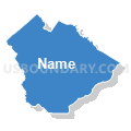
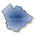
Beaufort & Jasper Counties--Hilton Head Island, Bluffton Towns & Beaufort City PUMA, South Carolina
About
Outline

Summary
| Unique Area Identifier | 193938 |
| Name | Beaufort & Jasper Counties--Hilton Head Island, Bluffton Towns & Beaufort City PUMA |
| State | South Carolina |
| Area (square miles) | 1,622.76 |
| Land Area (square miles) | 1,231.60 |
| Water Area (square miles) | 391.16 |
| % of Land Area | 75.90 |
| % of Water Area | 24.10 |
| Latitude of the Internal Point | 32.38679160 |
| Longtitude of the Internal Point | -80.83087740 |
Maps

Beaufort & Jasper Counties--Hilton Head Island, Bluffton Towns & Beaufort City PUMA in South Carolina
Download

Graphs
Select a template below for downloading or customizing gragh for Beaufort & Jasper Counties--Hilton Head Island, Bluffton Towns & Beaufort City PUMA, South Carolina


Neighbors
Neighoring Public Use Microdata Area (by Name) Neighboring Public Use Microdata Area on the Map
- Coastal Regional Commission (East)--Chatham County (East & Outside Savannah City) PUMA, GA
- Coastal Regional Commission (North)--Bulloch, Effingham & Screven Counties PUMA, GA
- Orangeburg, Colleton, Barnwell, Hampton, Bamberg & Allendale Counties PUMA, SC
Top 10 Neighboring County (by Population) Neighboring County on the Map
- Chatham County, GA (265,128)
- Beaufort County, SC (162,233)
- Effingham County, GA (52,250)
- Colleton County, SC (38,892)
- Jasper County, SC (24,777)
- Hampton County, SC (21,090)
Top 10 Neighboring County Subdivision (by Population) Neighboring County Subdivision on the Map
- Savannah CCD, Chatham County, GA (151,833)
- Bluffton CCD, Beaufort County, SC (52,777)
- Beaufort-Port Royal CCD, Beaufort County, SC (45,343)
- Hilton Head Island CCD, Beaufort County, SC (37,793)
- Rincon CCD, Effingham County, GA (31,639)
- Tybee Island-Wilmington Island CCD, Chatham County, GA (26,960)
- St. Helena Island CCD, Beaufort County, SC (22,051)
- Guyton-Springfield CCD, Effingham County, GA (17,399)
- Port Wentworth CCD, Chatham County, GA (16,797)
- Ridgeland CCD, Jasper County, SC (11,934)
Top 10 Neighboring Place (by Population) Neighboring Place on the Map
- Hilton Head Island town, SC (37,099)
- Bluffton town, SC (12,530)
- Beaufort city, SC (12,361)
- Port Royal town, SC (10,678)
- Burton CDP, SC (6,976)
- Laurel Bay CDP, SC (5,891)
- Port Wentworth city, GA (5,359)
- Ridgeland town, SC (4,036)
- Hardeeville city, SC (2,952)
- Shell Point CDP, SC (2,336)
Top 10 Neighboring Elementary School District (by Population) Neighboring Elementary School District on the Map
Top 10 Neighboring Secondary School District (by Population) Neighboring Secondary School District on the Map
Top 10 Neighboring Unified School District (by Population) Neighboring Unified School District on the Map
- Chatham County School District, GA (265,128)
- Beaufort County School District, SC (161,206)
- Effingham County School District, GA (52,250)
- Colleton County School District, SC (38,892)
- Jasper County School District, SC (24,777)
- Hampton School District 1, SC (13,703)
- Hampton School District 2, SC (7,387)
Top 10 Neighboring State Legislative District Lower Chamber (by Population) Neighboring State Legislative District Lower Chamber on the Map
- State House District 159, GA (88,115)
- State House District 118, SC (67,559)
- State House District 157, GA (49,943)
- State House District 163, GA (48,341)
- State House District 160, GA (46,989)
- State House District 161, GA (41,990)
- State House District 124, SC (37,330)
- State House District 122, SC (35,907)
- State House District 123, SC (35,356)
- State House District 121, SC (29,679)
Top 10 Neighboring State Legislative District Upper Chamber (by Population) Neighboring State Legislative District Upper Chamber on the Map
- State Senate District 1, GA (184,711)
- State Senate District 4, GA (182,797)
- State Senate District 2, GA (145,784)
- State Senate District 46, SC (131,108)
- State Senate District 45, SC (92,424)
- State Senate District 39, SC (88,126)
Top 10 Neighboring 111th Congressional District (by Population) Neighboring 111th Congressional District on the Map
- Congressional District 2, SC (825,324)
- Congressional District 1, GA (722,068)
- Congressional District 12, GA (692,529)
- Congressional District 6, SC (682,410)
Top 10 Neighboring Census Tract (by Population) Neighboring Census Tract on the Map
- Census Tract 107, Chatham County, GA (16,797)
- Census Tract 21.04, Beaufort County, SC (11,608)
- Census Tract 21.07, Beaufort County, SC (9,876)
- Census Tract 21.06, Beaufort County, SC (9,216)
- Census Tract 9502.02, Jasper County, SC (8,368)
- Census Tract 9.02, Beaufort County, SC (8,142)
- Census Tract 9503, Jasper County, SC (7,683)
- Census Tract 303.05, Effingham County, GA (7,561)
- Census Tract 9202, Hampton County, SC (7,228)
- Census Tract 9204, Hampton County, SC (6,590)
Top 10 Neighboring 5-Digit ZIP Code Tabulation Area (by Population) Neighboring 5-Digit ZIP Code Tabulation Area on the Map
- 29910, SC (33,954)
- 29926, SC (23,742)
- 29906, SC (21,765)
- 31326, GA (19,269)
- 29909, SC (16,394)
- 29928, SC (16,110)
- 29902, SC (14,779)
- 29936, SC (13,354)
- 29907, SC (12,570)
- 29920, SC (9,481)